 |
 |
|
|
 |
I pulled out the stove and boiled some water for my freeze-dried bacon
and scrambled eggs. It mixed up right in the bag. If you surrender any
illusion of them actually looking like scrambled eggs, theyre pretty good.
The bacon sinks to the bottom, so you have to stir it up.
In the office, I had a hot cup of tea and a nice talk with Mary, the owner of the RV park. She loved Kansas, because it didnt look like any place else on Earth. She said shed see kids hooked up to their Ipads or MP3 players ignoring the wonders of the world around them. It makes me want to say unplug! Turn off! Look around! she said. I bought a soda pop and a birthday card for a friend. |

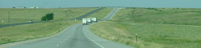
It was a quarter to 10 when I got to Goodland. (Welcome to the Good Life). About 18 minutes later, I crossed the state line into Colorado. Railroad tracks ran parallel to the highway along the northern side. I soon came to Burlington, Colorado (Where the Trip Begins). There was a Welcome Center at Exit 347. Denver was about 3 hours away. The landscape was still very Kansas-like, though the plains began to show subtle ripples. To the north, I could see a bunch of wind-powered generators. Rows of cedar trees standing guard alongside the interstate told me I was passing a Christmas tree farm. They reminded me of the "national windbreak" program that was attempted back in the 1930s. Thousands of trees were planted across the Great Plains in an attempt to slow down the winds of the Dust Bowl. The project was a total failure. You can still finds random rows of trees along the prairie sometimes.
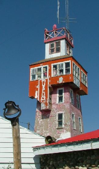 |
At Exit 371, I pulled off the highway and went through the little town
of Genoa, Colorado. Right after a sign that said Point of Interest 1 Mile,
the pavement turned into a bad, bumpy gravel road. Up ahead was what I
was looking for: the Wonder Tower. It was a tourist attraction built
way back in 1926 and for decades was a major stop on Highway 24. Signs
claimed you could see six states from the top of the tower, built on the
highest point between New York and Denver.
When I pulled up to the tower, there were cars out front, but no signs of life. The doors were locked, despite the OPEN sign in the window. I couldnt see anybody inside. There were rocks and antique tools and crystals set out on rickety tables. The wind was strong and chilly. The famous view from the top seemed reserved only for the blank states of the weatherbeaten mannequins propped up along the railings. From ground level, the view was still impressive. I waited for someone to appear, but when nobody did, I took some pictures and headed out. It was 95 miles to Denver. |
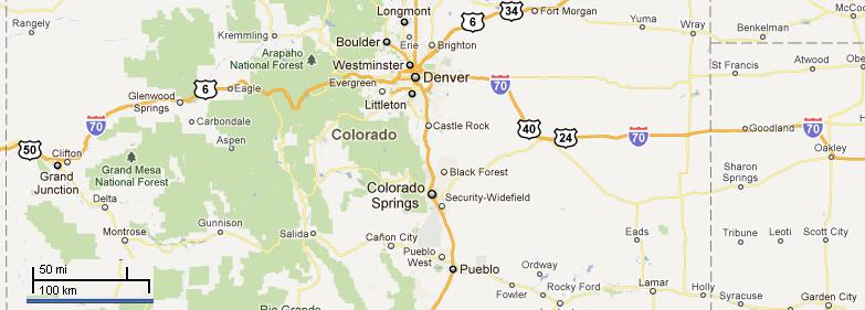
| Near Exit 299, there was a small pirate ship just sitting in the grass off to the south of the highway. It was so random. That was where I pulled over and got another $20 worth of gas ($3.39 a gallon) at a nearby station. Id been trying to budget myself on gas, but everything I read said gas got very expensive west of Denver, and I figured I wouldnt find anything cheaper that day. |  |
 |
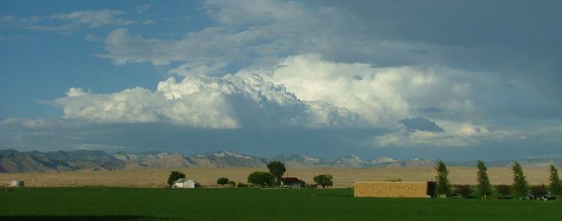
The further west I went, the angrier the clouds appeared. It looked like rain was falling on the mountainsides. There was a very nice church near the highway, and down the road I started seeing airplanes. Traffic picked up and got very heavy. It was just before 2 PM when I crossed the Denver city limits. The traffic kept me going at a good clip. I passed the Denver Mattress factory and, the local Bass Pro. I had been dreading the Mousetrap, the famous interchange where I-70 met I-25, but when it came up I went through it quickly and easily. Ahead lay an impressive wall of mountains. |

Satori seemed cooled off, so I got back on the interstate. Problems
persisted, however. The van strained against the uphill grade. The engine
sounded like it wasnt getting enough gas.
| I passed Silver Plume (elevation 9,118 feet) and headed for the Eisenhower Tunnel. The tunnel goes through the Rockies, topping out at 11,158 feet, the highest point on the whole interstate system. I hurried through the tunnel, thinking frantic thoughts of how much it would suck to break down in there. It was 3:30 when I emerged out the western side of the tunnel, and the road immediately plunged into a very steep downgrade. | 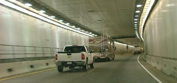 |
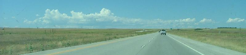
Id been up for 9 hours, but the local time was only 3 PM. Still, I needed to get a move on. The Dillon Reservoir made for a pretty lake outside of Frisco. I found myself on the Gerald R. Ford Memorial Highway. There were a bunch of cars at the Exit 190 rest area. Off to the side, through the trees, I could see bicyclists on the access roads. I had apparently come across the middle of a bicycle race. I could see people on bikes on both sides of the highway, even when the going got very steep near Vail Pass. Right before Eagle, Colorado, the interstate plunged into a steep valley. It seemed that Colorado had plenty of highway rest areas. I passed Gypsum right before 5 PM Central Time. Firewood was advertised selling for $135 a cord.
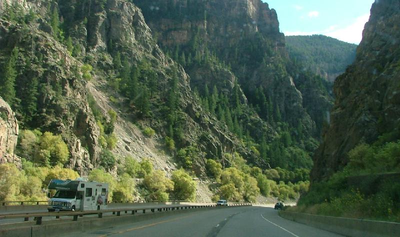
I crossed the Colorado River, and followed the highway into Glenwood Canyon. The views were simply amazing. The cliffs above me rose so high, I had to lean over the steering wheel to see up to the top. The canyon gets so narrow at points the east and westbound lanes of the interstate are almost on top of each other. It was really an engineering marvel. The views were breathtaking. I pulled off at the Grizzly Creek exit to chill for a minute and to check out the canyon bike trail. It was narrow, but looked fascinating. Under the interstate the banks of the Colorado were quiet and peaceful. The river was vibrant and churning, and I saw a couple of people getting out kayaks to launch.
I went through another tunnel at Mile Marker 116. I was still two hours
from the state line. I wondered if I would need to stop for gas yet again
that day. Once past Glenwood Canyon, I could see that it was raining way
off to the southwest. A sunbeam broke through the clouds, highlighting
a narrow valley to my left. At the town of Rifle, elevation 5,153 feet,
I was still 62 miles from Grand Junction. It was just after 6 PM (Central
Time) when I pulled off in the little town of Parachute.
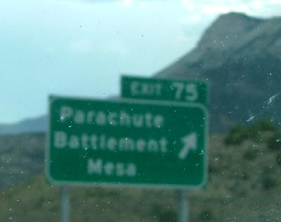 |
Parachute has an unusual history. In the 1960s, the government was
trying to find peaceful uses for atomic bombs. (Yes, you read that right.)
Outside of Parachute, geologists had found a reserve of natural gas, but
it was going to be too expensive to dig down to it. So, somebody had the
idea of setting off an atomic bomb underground to get to the natural
gas. (Kind of like what John Travolta did in the movie "Broken Arrow.")
In 1969, a 40-kiloton bomb was exploded about a mile underground.
The funny thing is, it worked--sort of. They got natural gas, all right. They got... radioactive natural gas. The government covered up everything with concrete, put a fence around it, and hoped nobody would remember. |
It was 7 PM Central Time when I rolled through Grand Junction. Dark, heavy clouds hung low in the western sky. It looked like it might be raining ahead. The temperature had dropped 10 degrees since Parachute. I had passed from the Front Range of the Rocky Mountains to the Western Slope. I saw several RV parks along the highway outside of town. There were some brief sprinkles on my windshield. Fruita had a dinosaur museum, but I didnt have time to visit it. The town is famous for being home to a headless chicken.
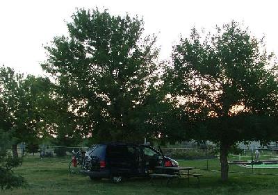
I got off at Exit 15 and headed north on Highway 139. There were fields of crops surrounding small farm houses. At Mile 5, I turned west on Q Road, and then north again. Ahead, surrounded by farmland, was an island of tall trees. That was Highline Lake State Park. The office was closed, so I used the kiosk outside, scanning my Visa card to pay the camping fees. The machine spat out a little receipt. The campsite lines the eastern side of a little lake. The Sun was very low as I pulled into the park. I found a flat place to camp under some trees and got out my stove to cook supper: chicken noodle soup. And a beer: Keystone, the beer that tells the world you just dont care any more. The park is at the end of a dead-end road, so the only traffic was day campers leaving at sunset. In the whole park, I only saw three cars and one RV spending the night. It was very peaceful.
While I was eating, the resident park ranger came by on his golf cart. He checked the receipt ticket I got when I paid my $18 overnight camping fee. He said I also had to pay an additional $7 day pass. That made the total $25 to camp at Highline, not what the web site said it would cost. That didnt seem right. Why did I need to pay a day pass if I didnt even arrive until the day was over? Since the office was closed, I had to wait and go in and pay the extra fee in the morning. He also said I parked wrong, too close to the water faucet. So, after I finished eating, I moved the van to a different campsite: flatter, and closer to the bathrooms, too. The added fees were unexpected and discouraging. I figured Id worry about the fees in the morning. Beer helped.
|
|
|
|
|
|