 The Journey East
I didnt sleep much at all that night. The bugle calls at 10 and 10:30
woke me up, and then there was the wind. It just howled down from the mountains,
shaking the trees around me. Between midnight and 4 AM, the wind just hammered
the base. Satori rocked back and forth like Id never experienced before.
It honestly felt like it was going to tip over. The winds had to have been
gusting at 60 MPH or more. I kept thinking, If there was a tornado,
would they sound sirens? It was a hellacious night. The winds finally
stopped shaking the car enough for me to fall asleep
until the bugle sounded
again at 6 AM. I lay there in the back of Satori, staring at the roof,
until the Sun came up at 7.
The Journey East
I didnt sleep much at all that night. The bugle calls at 10 and 10:30
woke me up, and then there was the wind. It just howled down from the mountains,
shaking the trees around me. Between midnight and 4 AM, the wind just hammered
the base. Satori rocked back and forth like Id never experienced before.
It honestly felt like it was going to tip over. The winds had to have been
gusting at 60 MPH or more. I kept thinking, If there was a tornado,
would they sound sirens? It was a hellacious night. The winds finally
stopped shaking the car enough for me to fall asleep
until the bugle sounded
again at 6 AM. I lay there in the back of Satori, staring at the roof,
until the Sun came up at 7.
It was Monday morning, March 30th. In the pre-dawn twilight, a platoon
of soldiers was out doing their morning run. I opened Satori's side door,
and found it was still pretty breezy out. I put on my shoes, no socks,
and hit the porta potties. My pants were noticibly looser. In the middle
of the awakening base, it was still pretty quiet. There were only a handful
of RV's and vehicles left from the Death March. I didn't know how long
we'd be allowed to stay there. I figured since the MP's hadn't come to
get me yet, I was still okay. There was still some water in one of my bottles,
so I used it to wash my hair. The advantage of having short hair is that
you don't have to worry so much about combing it.
 About 7:30, I pulled Satori out of camp. I didn't know the way out, but
fortunately one of the RV's was leaving, so I just followed him. I stopped
at Missile Park, the collection of vehicles near the base entrance, to
look around. I pulled out of the base, took the on-ramp to Highway 70 and
pointed myself back towards Alamogordo. Ahead, all northbound traffic was
redirected over to a big structure with a wide overhang. It looked like
a truck stop. It turned out to be a Border Patrol checkpoint. They asked
me if I was a U.S. citizen and looked in all my windows before sending
me on my way. I guess they were looking for illegal immigrants. I found
a radio station from Las Cruces. Part of the weather report included warnings
of times Air Force jets would be making sonic booms.
About 7:30, I pulled Satori out of camp. I didn't know the way out, but
fortunately one of the RV's was leaving, so I just followed him. I stopped
at Missile Park, the collection of vehicles near the base entrance, to
look around. I pulled out of the base, took the on-ramp to Highway 70 and
pointed myself back towards Alamogordo. Ahead, all northbound traffic was
redirected over to a big structure with a wide overhang. It looked like
a truck stop. It turned out to be a Border Patrol checkpoint. They asked
me if I was a U.S. citizen and looked in all my windows before sending
me on my way. I guess they were looking for illegal immigrants. I found
a radio station from Las Cruces. Part of the weather report included warnings
of times Air Force jets would be making sonic booms.
 I stopped at the White Sands visitor center and got a crushed penny. I
had meant to go through White Sands, but I think I'd had enough desert
for one weekend. I made a note to come back and hit the road. I got to
Alamogordo about 8:37. There's a neat museum in town, but it wasn't open,
so I kept going. Just north of town, I turned east on Highway 82 towards
Cloudcroft. Immediately, the road climbed into some dramatic mountains.
Traffic slowed to 40 MPH. It was slow going uphill into the mountains of
the Lincoln National Forest. Right after 9 I went through a tunnel, and
passed the town of High Rolls (elevation 6,750 feet). I was deep in the
forest when I went through Mountain Park, and the road just kept climbing.
I got to Cloudcroft at 9:21. I had meant to treat myself to a big breakfast
in Cloudcroft, but I didn't see anyplace to eat. I figured there'd be something
down the road.
I stopped at the White Sands visitor center and got a crushed penny. I
had meant to go through White Sands, but I think I'd had enough desert
for one weekend. I made a note to come back and hit the road. I got to
Alamogordo about 8:37. There's a neat museum in town, but it wasn't open,
so I kept going. Just north of town, I turned east on Highway 82 towards
Cloudcroft. Immediately, the road climbed into some dramatic mountains.
Traffic slowed to 40 MPH. It was slow going uphill into the mountains of
the Lincoln National Forest. Right after 9 I went through a tunnel, and
passed the town of High Rolls (elevation 6,750 feet). I was deep in the
forest when I went through Mountain Park, and the road just kept climbing.
I got to Cloudcroft at 9:21. I had meant to treat myself to a big breakfast
in Cloudcroft, but I didn't see anyplace to eat. I figured there'd be something
down the road.
 The road started a long, lazy descent eastwards. I passed narrow grazing
lands and sleepy little communities tucked away in mountain passes. There
was almost no traffic. It was a bright, cheerful morning under a cloudless
sky. At the Chaves County line, I left the Lincoln National Forest behind
me. The narrow canyons I'd been following all morning widened out into
broad valleys. Cattle grazed in lush, green fields. Just past the junction
for Highway 24, the ground was scorched from a recent fire. Blackened trees
and grass spread out for about 40 acres alongside the road. Trees became
few and far between east of there as the land turned into a dry prairie.
I could see down the road for miles. I found a radio station from El Paso,
I think. The weather report included a high wind warning. Behind me to
the west, I couldn't even see the mountains any more. At 10:30, I crossed
over into Eddy County. What looked like a town appeared on the horizon.
It was Hope, New Mexico, but there wasn't much to it. The Hope Store had
boarded-up windows. Twenty miles down the road, and 89 miles from Cloudcroft,
I arrived in Artesia, the "city of champions." I decided to finally get
my breakfast. Artesia has a Wal-Mart and a K-Mart, almost within sight
of each other. The downtown area has many statues and a classic old movie
theater.
The road started a long, lazy descent eastwards. I passed narrow grazing
lands and sleepy little communities tucked away in mountain passes. There
was almost no traffic. It was a bright, cheerful morning under a cloudless
sky. At the Chaves County line, I left the Lincoln National Forest behind
me. The narrow canyons I'd been following all morning widened out into
broad valleys. Cattle grazed in lush, green fields. Just past the junction
for Highway 24, the ground was scorched from a recent fire. Blackened trees
and grass spread out for about 40 acres alongside the road. Trees became
few and far between east of there as the land turned into a dry prairie.
I could see down the road for miles. I found a radio station from El Paso,
I think. The weather report included a high wind warning. Behind me to
the west, I couldn't even see the mountains any more. At 10:30, I crossed
over into Eddy County. What looked like a town appeared on the horizon.
It was Hope, New Mexico, but there wasn't much to it. The Hope Store had
boarded-up windows. Twenty miles down the road, and 89 miles from Cloudcroft,
I arrived in Artesia, the "city of champions." I decided to finally get
my breakfast. Artesia has a Wal-Mart and a K-Mart, almost within sight
of each other. The downtown area has many statues and a classic old movie
theater.
 I needed food but I didn't want just fast food, I wanted a meal. Going
down a side street, I spotted a little place called the Chaos Cafe. I went
in and ordered lunch with a Dr. Pepper. The soda pop came from a trough
in the middle of the room, filled with ice. They brought me my soda and
a glass of water, and halfway through my bacon cheeseburger they gave me
a brownie. It was my first big meal in days. It was a laid-back place.
The bathrooms were labeled "shirts" and "skirts."
I needed food but I didn't want just fast food, I wanted a meal. Going
down a side street, I spotted a little place called the Chaos Cafe. I went
in and ordered lunch with a Dr. Pepper. The soda pop came from a trough
in the middle of the room, filled with ice. They brought me my soda and
a glass of water, and halfway through my bacon cheeseburger they gave me
a brownie. It was my first big meal in days. It was a laid-back place.
The bathrooms were labeled "shirts" and "skirts."
 Heading out of town, I passed a lot of oilfield equipment. East of town
were huge acres of crops, dotted with "cow coolers." That's what
my Dad used to call the bobbing oil pumps; when I was a kid, he told me
the action fanned the nearby cows, keeping them cool. Hey, I was a kid,
what did I know? Large dust clouds appeared on the horizon. The air was
thick with the smell of oil. Just after noon, large waves of dust blew
across the highway in exactly the same way snow blew across just days before.
Heading out of town, I passed a lot of oilfield equipment. East of town
were huge acres of crops, dotted with "cow coolers." That's what
my Dad used to call the bobbing oil pumps; when I was a kid, he told me
the action fanned the nearby cows, keeping them cool. Hey, I was a kid,
what did I know? Large dust clouds appeared on the horizon. The air was
thick with the smell of oil. Just after noon, large waves of dust blew
across the highway in exactly the same way snow blew across just days before.
 The farmland fell behind me, and the land turned to rugged sandhills. The
turnoff for Hobbs appeared before I expected it. I turned off Highway 82
and onto Highway 529 towards Hobbs, hoping I was going the right way. It
was another lonely 2-lane road. Sandy grasslands spread out in all directions.
Dust devils danced in the road before me. Parched grass was everywhere.
The horizon was obscured with a haze of dust. The wind slammed down on
the countryside. I had forgotten how consistent the wind could be. In the
distance, smoke from an apparent grass fire mixed with the dust in the
air. The road turned into Highway 180, which took me right into Hobbs.
Fifteen miles from Hobbs, I came to a "T" intersection. I turned east;
going west would've taken me to Carlsbad. On the radio, a listener won
a contest prize: a free dinner. "And," the DJ added, "you get
to get out of the wind for a while!" Right before 1 PM I made it to
Hobbs. I made a pit stop at the Town & Country store. The car rocked
back and forth in the wind. I got a Dr. Pepper, even though the store was
stocked with Kist Cola.
The farmland fell behind me, and the land turned to rugged sandhills. The
turnoff for Hobbs appeared before I expected it. I turned off Highway 82
and onto Highway 529 towards Hobbs, hoping I was going the right way. It
was another lonely 2-lane road. Sandy grasslands spread out in all directions.
Dust devils danced in the road before me. Parched grass was everywhere.
The horizon was obscured with a haze of dust. The wind slammed down on
the countryside. I had forgotten how consistent the wind could be. In the
distance, smoke from an apparent grass fire mixed with the dust in the
air. The road turned into Highway 180, which took me right into Hobbs.
Fifteen miles from Hobbs, I came to a "T" intersection. I turned east;
going west would've taken me to Carlsbad. On the radio, a listener won
a contest prize: a free dinner. "And," the DJ added, "you get
to get out of the wind for a while!" Right before 1 PM I made it to
Hobbs. I made a pit stop at the Town & Country store. The car rocked
back and forth in the wind. I got a Dr. Pepper, even though the store was
stocked with Kist Cola.
 Going through town, I was surprised to find the Lamplighter Motel! Way
back when I was a first grader, Dad used to take me on week-long trips
with him out to the oil fields where he worked. We used to stay at the
Hobbs Lamplighter when he was doing jobs in the area. The town had become
much more developed. I remembered the Lamplighter being on the edge of
town, with nothing beyond the curve in the road, but I passed a lot more
before leaving Hobbs. It was five miles to the state line. As I crossed
into Texas, 1:16 PM became 2:16. Speed limit on Texas roads was 70 MPH
(65 at night). Plowed fields stretched as far as I could see. Long irrigation
machines worked their way across the furrowed acres. Thick dust storms
roared to the north. I dodged a tumbleweed as it bounced across the median.
The air was thick with the smell of dust and oil. At a farm house, a ragged
American flag looked exhausted as it flapped in the stiff breeze.
Going through town, I was surprised to find the Lamplighter Motel! Way
back when I was a first grader, Dad used to take me on week-long trips
with him out to the oil fields where he worked. We used to stay at the
Hobbs Lamplighter when he was doing jobs in the area. The town had become
much more developed. I remembered the Lamplighter being on the edge of
town, with nothing beyond the curve in the road, but I passed a lot more
before leaving Hobbs. It was five miles to the state line. As I crossed
into Texas, 1:16 PM became 2:16. Speed limit on Texas roads was 70 MPH
(65 at night). Plowed fields stretched as far as I could see. Long irrigation
machines worked their way across the furrowed acres. Thick dust storms
roared to the north. I dodged a tumbleweed as it bounced across the median.
The air was thick with the smell of dust and oil. At a farm house, a ragged
American flag looked exhausted as it flapped in the stiff breeze.
 I got to Seminole at 2:42 Texas time. Texas likes to make their roads as
straight east-west and north-south as you can get, and Highway 180 was
no exception. A cloud of dust blew across the road. About an hour east
of Hobbs, a Texas State trooper passed me in a big hurry. At 3:19 I made
it to Lamesa, "home of the Tornadoes." The Sun beat down relentlessly through
the clouds of dust. It was very hot out. Crossing Highway 87, the sign
for Big Spring took me by surprise. It was the first time I'd seen a sign
pointing towards the town where I was born in, well, decades. There just
wasn't time for a side trip, nor was I emotionally prepared to go back
to my hometown. Maybe some other trip. Near Key, Texas, the road went down
an escarpment. A silver pickup passed me. As soon as I crossed into Borden
County, the pavement dramatically changed in character. The land became
more rugged. The sky was hazy with dust. A dry ridge lurked to the north.
I passed a big mountain before entering Gail, Texas, the county seat of
Borden County, "home of the coyotes."
I got to Seminole at 2:42 Texas time. Texas likes to make their roads as
straight east-west and north-south as you can get, and Highway 180 was
no exception. A cloud of dust blew across the road. About an hour east
of Hobbs, a Texas State trooper passed me in a big hurry. At 3:19 I made
it to Lamesa, "home of the Tornadoes." The Sun beat down relentlessly through
the clouds of dust. It was very hot out. Crossing Highway 87, the sign
for Big Spring took me by surprise. It was the first time I'd seen a sign
pointing towards the town where I was born in, well, decades. There just
wasn't time for a side trip, nor was I emotionally prepared to go back
to my hometown. Maybe some other trip. Near Key, Texas, the road went down
an escarpment. A silver pickup passed me. As soon as I crossed into Borden
County, the pavement dramatically changed in character. The land became
more rugged. The sky was hazy with dust. A dry ridge lurked to the north.
I passed a big mountain before entering Gail, Texas, the county seat of
Borden County, "home of the coyotes."
 There's not a lot to Gail beyond an intersection or two. The county courthouse
even looked empty. Beyond, cattle grazed in fields littered with gnarled
mesquite trees. The town of Mesquite, Texas was not far away. At 4:07,
the ghosts of my childhood returned again as I passed the turnoff for Lake
Thomas. When Dad had a motorboat, we'd spend a day out on the water at
Lake Thomas. The pavement of the road changed again as I pulled into Scurry
County.
There's not a lot to Gail beyond an intersection or two. The county courthouse
even looked empty. Beyond, cattle grazed in fields littered with gnarled
mesquite trees. The town of Mesquite, Texas was not far away. At 4:07,
the ghosts of my childhood returned again as I passed the turnoff for Lake
Thomas. When Dad had a motorboat, we'd spend a day out on the water at
Lake Thomas. The pavement of the road changed again as I pulled into Scurry
County.

 I soon went through Snyder, Texas, where I drove around the courthouse
square. There's an unusual statue of a white buffalo on the square, which
surrounds the granite crypt of the Scurry County courthouse. The courthouse
looks like it was based on the old Atari logo. Towering wind generators
dominated the skyline as I headed east out of town. Down the road, Fisher
County started out as pretty farm country, then quickly turned into miles
of fields full of cactus and mesquite. Rugged grazing land followed. The
Snyder radio station said it was 80 degrees out. I got to Roby, Texas (population
673) right at 5 PM. It was a few miles out of town that I made a side trip.
I turned off 180, and went under an overpass onto Highway 57. I was on
a pilgrimage to a place I'd never been before. Eleven miles down the road,
I came to the little town of Hamlin, Texas ("home of the Pied Pipers").
It's a small town, yet surprisingly dynamic and full of local pride. Acting
on directions from my big brother, I pulled down a side street and found
a boxy little house. It was the first home my parents moved into when they
settled down to have a family. I have no memories of Hamlin; my family
moved to Big Spring before I was born... but finding that humble little
house, I felt like I was looking at a living page of history, like looking
back through time... but time was not on my side. The Sun was getting lower
in the sky, and I had to move on.
I soon went through Snyder, Texas, where I drove around the courthouse
square. There's an unusual statue of a white buffalo on the square, which
surrounds the granite crypt of the Scurry County courthouse. The courthouse
looks like it was based on the old Atari logo. Towering wind generators
dominated the skyline as I headed east out of town. Down the road, Fisher
County started out as pretty farm country, then quickly turned into miles
of fields full of cactus and mesquite. Rugged grazing land followed. The
Snyder radio station said it was 80 degrees out. I got to Roby, Texas (population
673) right at 5 PM. It was a few miles out of town that I made a side trip.
I turned off 180, and went under an overpass onto Highway 57. I was on
a pilgrimage to a place I'd never been before. Eleven miles down the road,
I came to the little town of Hamlin, Texas ("home of the Pied Pipers").
It's a small town, yet surprisingly dynamic and full of local pride. Acting
on directions from my big brother, I pulled down a side street and found
a boxy little house. It was the first home my parents moved into when they
settled down to have a family. I have no memories of Hamlin; my family
moved to Big Spring before I was born... but finding that humble little
house, I felt like I was looking at a living page of history, like looking
back through time... but time was not on my side. The Sun was getting lower
in the sky, and I had to move on.
I figured I had just over two hours of sunlight left. I headed east
on Highway 92, past plowed fields dotted with oil wells. Just before 6,
I passed Tuxedo, Texas ("Once a town, now a farming community") and waved
to a farmer driving a tractor beside the road. I turned north on Highway
277, an easy, 4-lane road. It looked like I could take 277 all the way
to Wichita Falls. There was a fierce crosswind, but it didn't matter which
direction the wind was coming from; you still got knocked around. Just
after 6:30, I went through Munday, Texas, and I had to smile. (My cat's
name is Munday.) It was 67 miles to Wichita Falls. At the Baylor County
line, 277 turns into a 2-lane road. I passed bicyclists struggling against
the wind. Around Seymor, 277 splits into a 4-lane road again. Tumbleweeds
danced near the Brazos River as I pulled over for some gas. I was still
26 miles short of Wichita Falls when the Sun dipped below the horizon.
I made it to Wichita Falls as dusk settled over the Texas plains. Once
in Wichita Falls, I followed 277 until it hooked up with Highway 281. I
headed south, watching a brooding thunderhead in the eastern sky
pulse with lightning. I stayed south on 281 until I saw the signs for Lake
Arrowhead State Park. (I had trouble finding it because I had been mis-pronouncing
it as "Arrowhead Lake.") I drove through the empty front gate and pulled
into the first empty campground I could find. There were six campsites
in the area I found, and I was completely alone. I had been on the road
almost 12 hours. I called home, sent text messages to friends, and settled
down for the night. A beautiful crescent Moon hung low in the west. Above,
diamond stars twinkled in the bosom of the Milky Way. I hadn't seen the
Milky Way since Burning Man. In the east, the thunderstorm lumbered away
from me, leaving flashes of lightning in its wake. The air turned icy.
I climbed inside Satori, curled up in my sleeping bags and quickly went
to sleep.
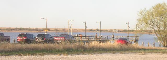
I woke shortly before dawn Tuesday morning. I figure I'd slept for 7
hours-- the best night's sleep I'd had in days. The night had been nowhere
near as cold or as windy as the rest of the trip. The eastern sky slowly
brightened to a baby blue, and then a pale yellow before the Sun finally
poked up over the horizon. I chugged a can of V-8, then drove Satori deeper
into the park. I found the showers not far down the access road. The hot
water took a minute to kick in, but it was great to be clean again. In
the daylight, I saw the showers were surrounded by campsites, next to a
working oil rig. I'm not sure I could've slept next to the racket it made.
Fishermen were already out on the lake.
 I drove to the front gate to pay my camping fee. The Ranger said I was
actually in an electric hook-up area, which charged more, but since I didn't
plug anything in he only charged me $12 for the night. As I left, I said,
"Nice place you got here." The Ranger laughed and replied, "Bring you
a fishin' pole next time!" I drove back to Highway 281, past the Texoma
Coyboy Church, and headed back through Wichita Falls.
I drove to the front gate to pay my camping fee. The Ranger said I was
actually in an electric hook-up area, which charged more, but since I didn't
plug anything in he only charged me $12 for the night. As I left, I said,
"Nice place you got here." The Ranger laughed and replied, "Bring you
a fishin' pole next time!" I drove back to Highway 281, past the Texoma
Coyboy Church, and headed back through Wichita Falls.
It was a bright, cheerful day, with a few high clouds to the west. Taking
Interstate 44, I crossed the Red River back into Oklahoma, and between
there and Oklahoma City I ended up paying tolls three times! No wonder
truck drivers avoid Oklahoma. When I got to Oklahoma City, I guess I was
tolled-out, because when I got to the exit for the Turner Turnpike I skipped
it and went on up to Edmond, where I got on the old Route 66. I stopped
at Pop's in Arcadia for some soda. They had Dublin Dr. Pepper! I followed
the old Route 66 all the way back to Tulsa. The Deep Fork River was very
red when I crossed it. In Chandler, the temperature was 51 degrees. Stroud
had a winery right in the middle of town. I got to Kellyville at 1:30,
and pulled into Broken Arrow right at 2 PM. I rolled into the driveway
at 2:23. I had driven 1,719 miles in 5 days. It was good to be home. After
I cleaned up, I weighed myself on the bathroom scales. After five days
of sporatic meals, fitful sleep and 26 miles of hiking, my weight had not
changed at all. Who says God doesn't have a sense of humor?
My reasons for doing the Death March are complex. It's not a coincidence
that my route took me down so many roads that were familiar to my Dad.
I planned it that way so that I could see those country roads as he saw
them. My parents were foremost on my thoughts as I walked those long dusty
miles.
| It's about Duty. Dad was 30 years old when the Japanese bombed
Pearl Harbor. He had a career, a life, but he enlisted in the army and
served "four days shy of four years" in the European Theater. Mom had a
prosperous career as a doctor, but after she and Dad married, she set it
all aside to care for her family. I don't think there's anything they wouldn't
have done for each other.
It's about Sacrifice. Working to provide for his family, Dad
traveled all over west Texas and put up with blinding dust storms, scorching
summer heat and bitter winter storms. Dad's job took him through every
small town in Texas; he could tell you where every one was, how to get
there, and where to get the best cup of coffee. He endured the harsh routine
of his job for decades-- but he persevered and put three kids through college.
Mom worked hard keeping the house in order, while also keeping busy with
social and environmental causes. Together, they managed to raise a family
that respects and loves each other, never fights with each other, and always
drops what they're doing to help each other. In the early 21st Century,
that's quite an accomplishment.
It's about Honor. Dad passed away in 1999. We lost Mom in February,
2009. The world will never see their like again. Any part of me that's
good, honest and decent exists because of them. It was in their honor that
I did the Bataan Memorial Death March.
 Mom, Dad, this was for you. I love you.
 |
Back to BurningClam.Com