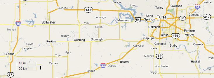
I hit the road west right after 7 AM. The air was cool. The full Moon was low in the western sky. I got on the turnpike, but didnt stay on it long. Just before 7:30 I got off the turnpike at the Kellyville exit and turned west on Highway 33, passing the Blue Bell Free Will Baptist Church. It was a good two-lane road with passing lanes on the hills. I passed the Dripping Springs Church before crossing Tiger Creek. Traffic was pretty steady as I traveled through lots of wooded, rolling hills. A dog ran through an open field. Kids sat beside the road, waiting for the school bus. A stately, columned house sat on the crest of a hill as a flock of geese grazed around a nearby pond. The air smelled clean and fresh.
I crossed over Lost Creek, near Perkins, just before 8:30. An RV park run by the Iowa Tribe sat near the intersection with Highway 177. I started passing oil wells in the fields, cow coolers with grazing cattle nearby. The road was lined with lots of little family farms with neat, trim houses, one of which had an Impeach Obama sign out front. Over a short hill, I passed St. Francis of the Woods Church. I crossed the Cimarron River on the Newt Sexton Memorial Bridge. Down the road was Langston University. Id never been there, so I pulled in to drive around the campus. Langston had been there since 1897, but all the buildings I saw looked relatively new.
Back on the wide, 4-lane road, I was on the Dr. Ernest L. Holloway Highway, which turned southward for a while. A big overpass took me over Interstate 35, and soon I was pulling into Guthrie, Oklahomas first capital. Red bricks, probably part of the original road, marked the center of the highway. I turned downtown and parked just off Oklahoma Avenue. I walked around the more-than-century-old buildings, remarkably preserved and cared for. There were whole neighborhoods of period houses, many with the original brick sidewalks out front. Guthrie is a time capsule, and it wasnt hard to imagine wilder days of horses and gunfights.

Six miles out of town I crossed Kingfisher Creek. There were lots of plowed fields, ready for planting fall crops. One field had the derrick of a new oil well going up. I passed a group of buildings. It was the Chisolm Trail Technology Center. In the sky, vultures circled over some roadkill. Id seen more vultures that year than ever before. A dog barked at me from the side of the road as I went through Watonga. Broad, green fields greeted me outside of town as I came up on the North Canadian River. The road was a comfortable 4-lane highway. I saw lots of trees, and little white flowers along the shoulderQueen Anns lace? The road turned south, and I crossed over the mostly dry South Canadian River. Tall grain elevators loomed over Thomas, Oklahoma.(Let it Be Your Future.) A house advertised quilts for sale. There were two cars at the Nite Owl Motel, down from the vintage Thomas Drug Store. I passed Mound Valley Cemetery on my way out of town; I could see wind-powered generators way off to the south. Railroad flatcars waited on an old wooden trestle.
I got to Custer City just before 11:30. I counted one store there. The
road was very straight headed west past lush green farm land. I crossed
Beaver Creek. I needed some gas, but when I got to Butler there were no
gas stations. I kept goingit was 11 miles to Hammond. It was getting hot
out. Horses in fields crowded together for shade under lone trees. I entered
the Washita National Wildlife Refuge and crossed the Washita River. Oklahoma
red dirt was everywhere. A red tailed hawk zoomed across the road in front
of me. I had to stop for some construction in the road ahead. The flagger
told me they were milling the road. I said I was from Tulsa, and he said
the main characters in the movie The Hangover were from Tulsa. We talked
about cool mornings, and he said, Bet you liked that weather! I didnt
have to wait long.
| At Hammon, I stopped for gas at BJs Quik Stop, next to Carolyns Kountry Kitchen and across the road from Cutlers Cowboy Junction. Id gone 362 miles since I filled up right before leaving home. From Hammon, the road angled north, and I crossed the Washita a couple more times. Oil pumps dotted fields of exposed dirt. There were lots of hay bales waiting to be hauled somewhere. There was a dark, rusty water tower in Strong City. I saw no businesses, nor did it look like it had ever had any. |  |
I turned west on Highway 47, the Black Kettle Memorial Highway, and crossed Sergeant Major Creek to get to the Washita Battlefield. At the visitor center, I was the only one in the little theater to watch a short movie about the battle, which was little more than an attack by George Custer on a campground of old and sick people. Three battles in American history summarize the conflict between the Native Americans and the white settlers: Washita, Sand Creek, and Little Big Horn. I looked through the museum, which talked about the history surrounding the battle, and picked up some souvenirs in the gift shop. I drove down to where the trail started and parked the car.


It was just after 3 PM when I crossed the border into Texas. The texture of the pavement changed right at the border. The roadside park I stopped at my first trip to Burning Man was still closed, weeds high around the benches. The Sun was bright in the western sky. Id been driving for a long time and I was getting kind of bleary-eyed when I stopped at the Taylor Store in McLean, Texas. A girl named Teresa sold me a 96 cent fountain drink. Down the road, tall corn lined the highway. I passed the big cross at Groom at 4:17. Two big helicopters passed overhead, both flying due west along the interstate. I couldnt find anything good on the radio, so I started listening to my MP3 player. A roadside parked looked overgrown with weeds.
It was about a quarter to 5 when I got to Amarillo. I zoomed through town, but then got off at Exit 66 and turned around. I drove back eastward on the access road because there was something I wanted to see: Cadillac Ranch. I had passed it many times on my trips westward, but I hadnt actually stopped to look around in 10 years. It was further from the road than I remembered. There were about five or six other cars there when I stopped. Plowed rows of crops came almost right up to the cars, which were covered with spray-painted graffiti. Exploded fireworks and litter was everywhere. I took some pictures. Some dorky guy in a blue shirt kept getting in all my shots. The air was still. There was a big semi truck stopped right behind my car when I left. I think he was waiting for my place.

| I went back to the exit, and stopped at the convenience store for a soda. A guy cut in line ahead of me and then held the line up for everybody when he tried to buy gas. I headed west again. I passed more wind-powered generators at Mile Marker 48. I also passed a couple of people on bicycles. I wondered if they were biking the whole length of Route 66. |  |
 |
The landscape was mostly flat, except for some impressive bluffs right
before I got to Logan, New Mexico, 22 miles from San Jon. It was just after
7 PM Central Time.
I stopped at the Alsups store for $10 worth of gas (at $2.85 a gallon) and some beer. From there, it was a short drive west to Ute Lake State Park. |
The cellphone said it was 10:30 (Mountain Time) when I woke up. The Moon was rising triumphantly in the east. As I lay in my tent, I heard my cellphone chirp. The battery was dead! I could hear the guys in the other camp partying and playing musicI looked on it as practice for when I got to the playa. I went back to sleep The rustle of wind through the trees woke me up; it almost sounded like rain. The Moon was well up in the sky. The pocket watch said it was 4:30 AM. I got five hours of sleep? When I walked to the bathrooms, the moonlight so bright I couldve read a book. It didnt take me long to fall back asleep...

|
|
|
|
|
|