 The Journey East: Provo to Pueblo
There was frost on the windows when I woke up Tuesday, September 2nd.
It was not yet dawn, 6:45 Utah time. I could hear birds chirping in the
trees. Cows grazed in a neighboring field.
Out in the dewy grass, a covey of quail emerged from the bushes and
started hunting for food. They broke when I got out my camera
except for
a lone quail, who stood his ground. When he saw I wasnt a threat, the
rest of the quail came out and resumed their breakfast, under the watchful
eye of the Lone Quail. |
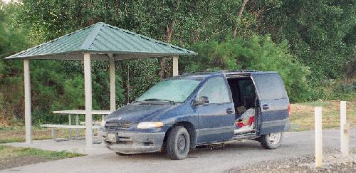 Campsite, Utah Lake State Park
|
Above, a squadron of geese flew in formation. Thats when I noticed a patch
of snow on one of the nearby peaks, possibly Provo Peak. It was time to
get moving. I found the showers, and had my first hot shower in over a
week. That first hot shower after Burning Man is almost a religious experience.
I changed into my cleanest dirty clothes, and decided to wear underwear.
The first rays of daylight were poking over the mountains as I cleaned
all the trash out of my car. Seagulls as big as chickens loitered around
the marina. I hooked up the bike to the back of the van and headed out
at 8:26. At a Walkers convenience store down the road, I got gas, a Dr.
Pepper and a hot dog for breakfast. I couldve picked up a pail of nightcrawlers,
too, had I been so inclined. I took I-15 south to Highway 6 and headed
east towards Price. The Sun was already high in the sky. A half-dozen wind-powered
generators stood guard at the edge of a steep, green valley. The road got
tricky as it made its way through the mountains. I kept getting glimpses
of beautiful mountainsides, but I dared not get out my camera. Scars and
scratches along the guard rails told me what happened to folks who didnt
pay attention to the road.
 About an hour after leaving camp I topped the Soldier Summit, at 7,477
feet. The mountains seemed to smooth out a little on the downhill run,
but that didnt last. A sign warned of more dangerous curves for the next
10 miles, and they werent kidding. The road went into some dizzying twists
and turns as magnificent cliffs rose above me. I was going through Price
Canyon, and the views were magnificent
from what I could see through the
dirty windows. By the time I got to Helper, Utah, I couldnt stand it any
more. I pulled off the highway and found a car wash for Satori. Puddles
of beige water pooled under the car as I washed it off. Helper is an old
mining town. Theres even a refurbished Muffler Man statue, made to look
like a coal miner. The downtown was charming, except for the many for
sale signs.
About an hour after leaving camp I topped the Soldier Summit, at 7,477
feet. The mountains seemed to smooth out a little on the downhill run,
but that didnt last. A sign warned of more dangerous curves for the next
10 miles, and they werent kidding. The road went into some dizzying twists
and turns as magnificent cliffs rose above me. I was going through Price
Canyon, and the views were magnificent
from what I could see through the
dirty windows. By the time I got to Helper, Utah, I couldnt stand it any
more. I pulled off the highway and found a car wash for Satori. Puddles
of beige water pooled under the car as I washed it off. Helper is an old
mining town. Theres even a refurbished Muffler Man statue, made to look
like a coal miner. The downtown was charming, except for the many for
sale signs.
The local dinosaur museum advertised Stomp by for a visit. I made
it to Price just before 10:30. The landscape widened into lush green farms,
but they soon passed behind me, leaving vast tracks of dry plains. A range
of fierce peaks flanked the wide valley. It was another 60 miles to Green
River. I listened to a CD of bagpipe music. I turned east on Interstate
70 and pulled off when I got to Green River (which looked kinda red to
me). The city park was pretty. I got some gas ($4.09 a gallon) then continued
on I-70 towards Grand Junction. I drove through some beautiful badlands
as massive blue shapes loomed to the east. Two big crows rested on a speed
limit sign. I found myself behind a truck marked Exodus Moving & Storage.
A range of red and purple cliffs pointed the way to Colorado. I crossed
the state line just before 2 PM. I could see lots of houses and green yards
from the highway.
 Dalton Trumbo statue in Grand Junction
|
When I got to Grand Junction, I pulled off the highway and followed
the signs towards the downtown area. Downtown Grand Junction is completely
charming: wide, friendly streets, interesting shops, big, shady trees,
and art everywhere. There was literally art on every street corner. I had
to laugh at the statue of Dalton Trumbo, sitting in a bathtub with a rubber
ducky.
Ever since leaving the playa, Id been promising myself a steak dinner,
and by God, I was gonna get one. I found a 50s-era restaurant called the
Main Street Café and had their regular steak dinner. (For the
large dinner they just added a second steak.) It was pretty good. When
I went to pay, however, I had something of a shock. It seems my wallet
had less cash than Id been presuming it had. A lot less. This changed
things. My itinerary remained the same, except that with not so much cash
that meant Id have to start using the ATM card to get home. Id really
hoped I wouldnt have to do that, trying to do the radical self-reliance
thing, but at that point there wasnt any choice. I got some gas ($3.89
a gallon) and hit the road. |
It was 69 degrees when I left town at 2:26 PM Mountain Time. Becka
sent a text message that they ran out of gas, but were soon rescued by
AAA. It was a beautiful day on the high plains. Fluffy white clouds danced
across the horizon. I passed Rattlesnake Gulch with some purple mesas to
the south. About a half hour later, I went through Delta, Colorado, which
had a beautiful Egyptian-style movie theater. I listened to an oldies radio
station. Going through Montrose, I had to hang a left down Main Street
to follow Highway 50 east. Down the highway was Black Canyon National Park.
I was sorely tempted, but it cost $15 to get in, and it was already mid-afternoon
and I still had many miles to go
I had to let Black Canyon go. Two hours
out of Grand Junction I topped Cerro Summit, elevation 7,950 feet, although
it was not well marked.
My mind wandered to the past week, and things that had bothered me,
which just reminded me of other things that bothered me, and in no time
at all I was in a sour, crummy mood. It was time for a pit stop. Ever since
Burning Man, Id been peeing like a race horse. The next place down the
road was Cimarron, Colorado. I stopped at a little general store called
Newberrys, which had wooden floors and lots of crystals for sale. I got
a Dr. Pepper, some beer and sandwiches for supper, and hit the road again.
Now that I had supper in the cooler, I made myself relax and enjoy the
Rocky Mountains. The grade was steep and curvy going up to Blue Mesa Summit,
elevation 8,704 feet. I passed rolling hills of freshly-cut grass, all
baled-up and piled near the highway. At a cut up ahead, a sign warned of
falling rocks and they werent kidding. A westbound car had to swerve
to miss the softball-sized rock in its lane. The road took me through a
deep, shadowed valley, then back into the rolling hills. Blue water appeared
ahead. As I came up to Sapinero, the road took me around what looked like
a series of lakes. It was really one big one: the Blue Mesa Reservoir.
I was in the Curecanti National Recreation Area, and it looked like a fun
place to be. Lots of vacation houses clustered around the lake, which seemed
to go on and on as the highway followed and criss-crossed it. The rich
blue waters were hypnotic. Lush, wooded hills surrounded picnic areas.
There were lots of RV parks along the way.
 Near the Gunnison National Forest. People still find undiscovered
Anasizi ruins in the Gunnison Forest.
I got to Gunnison about 5:30 Colorado time. It was home of Western State
College, and was the turn-off point for the Crested Butte area. My friend
Sherry sent me a text message: Are you humming Rocky Mountain High yet?
Outside of town, I found several cars following close behind me. I hate
that. Its like having someone read over your shoulder. They finally went
about their business. By then, the clouds had turned grey as the Sun started
to go down. I passed lots of farms: tiny, family farms nestled right up
against corporate operations. About 30 miles out of Gunnison, I passed
Dawson Creek! There really was one.
Near the Gunnison National Forest. People still find undiscovered
Anasizi ruins in the Gunnison Forest.
I got to Gunnison about 5:30 Colorado time. It was home of Western State
College, and was the turn-off point for the Crested Butte area. My friend
Sherry sent me a text message: Are you humming Rocky Mountain High yet?
Outside of town, I found several cars following close behind me. I hate
that. Its like having someone read over your shoulder. They finally went
about their business. By then, the clouds had turned grey as the Sun started
to go down. I passed lots of farms: tiny, family farms nestled right up
against corporate operations. About 30 miles out of Gunnison, I passed
Dawson Creek! There really was one.
| I got to Sargents, Colorado right at 6 PM. I had another 125 miles
to Pueblo. The road turned steep as I climbed towards Monarch Summit. The
speed limits kept lowering: 40 MPH, 35 MPH, 30 MPH
Satoris temperature
gauge started climbing again. I thought I smelled burning oil. The road
seemed way too narrow as it wound up the mountain. My ears kept popping.
I tried to keep my eyes on the road. When I dared to take a split-second
to glance out to the sides, the views were breathtaking. Satoris engine
was starting to complain, but then Monarch Pass emerged from the trees
ahead. I stopped to take a picture at the Continental Divide. At 11,312
feet elevation, that was the highest Id gone the whole trip. The visitor
center was closed. A couple of semi trucks were parked there, resting up
for the downgrade. |
 |
 The view from Monarch Summit
On the downward side, I passed a truck pulling a huge turbine, struggling
up the grade. The truck in front of me was only going 20 MPH, its brakes
complaining loudly. About two miles down the mountain, I passed a runaway
truck ramp off the side of the road. Dark skidmarks on the road indicated
it was recently used. The light was fading as I entered the San Isabel
National Forest. A sign told me I was near the headwaters of the Arkansas
River. At a quarter to seven, I made it to Poncha Springs. I felt like
Id really accomplished something. The prices at the gas stations were
noticeably lower. I passed a store called Leaf & Jug. Powerful crosswinds
struck as I looked back at the imminent sunset.
Brooding cliffs ignored me from above as the highway took me east into
Bighorn Sheep Canyon. Even in the dim twilight, I could tell by the patterns
in the cliffs that this was an area of high geologic disturbance. Several
small tourist towns passed by: Coaldale, Cotopaxi, Texas Creek, with dark
windows and empty parking lots. My eyes were starting to get bleary.
 The Sawatch Range of Colorado contains eight of the twenty highest
peaks in the Rocky Mountains.
The Sawatch Range of Colorado contains eight of the twenty highest
peaks in the Rocky Mountains.
|
Night took a long time to fall, probably because of the mountains. I passed
the turn for Royal Gorge. When I first planned my trip, Id set out the
route as counter-clockwise, expecting to pass Royal Gorge in my second
day on the road. Id have to miss it this time. The bar seemed to be doing
good business.
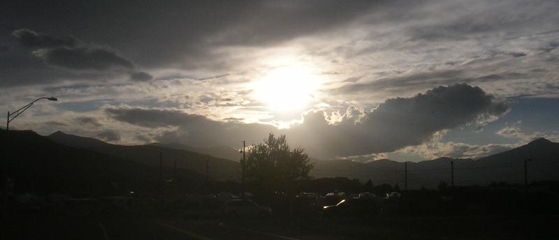
 Approaching the Rocky Mountains at dusk
|
It was just before 8 when I got to Canon City. It was 62 degrees in
town. The dinosaur museum was closed. A sign in the city park declared
it was our home. It seemed to take forever to get through town, because
of the zillions of stoplights, but once outside of town the road straightened
out and I was able to speed up to 65. I really had to go to the bathroom.
On the outskirts of Pueblo, I thought I saw a sign for the campground Id
planned on staying at, which was south of the highway, so I turned south.
Following the road, it turned back west, the way Id come. I got back on
the highway and took the next road south, which also turned west. I stopped
at a store for directions. The girl said to follow the road and turn left
at Nichols. I followed the road, but there was no Nichols Road. At a different
store, I asked where the state park was, and the counter girl said, You
mean the city park? I was starting to get really frustrated. A customer
finally gave me directions: go to the light, turn right, turn right, turn
right, and then turn right. I finally found the park, paid my fee, almost
drove into the water, and pulled into a campsite right at 9:30.
I ate my sandwiches and drank my beer, but I was still too keyed-up
to sleep. I found the bathrooms, which had coin-operated showers and a
laundry. In the darkness, I could see quite a number of vehicles in the
campsite, the fullest Id stayed at. One of the campers had a tiny blinking
red light; it was like I had a Cylon for a neighbor. Clouds seemed to be
moving in. I thought I saw lightning in the distance. My friend Sherry
sent a text: Rest well, weary traveler. Becka sent a text that they were
still on the road in Wyoming; they were headed for Denver, and hoped to
cross into Colorado about 1 AM. I figured Id traveled 533 miles in 13
hours. I finally relaxed enough to fall asleep.
Black Rock City to Provo
|
 Pueblo to Broken Arrow
 |